Before starting the article, I would like to thank those who have supported me on QO-100, especially Mr. Zhao (BG0AUB). Mr. Zhao's posts provided valuable information about the basic knowledge and practical aspects of operating QO-100 satellites. I learned a lot from his experience. Furthermore, the core equipment for this expedition to QO-100 in Guangxi was also made by Mr. Zhao, with excellent specifications and proper functioning. Finally, I would like to thank BI1QJQ. His support was crucial, as the conditions were challenging and difficult. Without his help, this expedition would not have been successful.
Satellite Overview
Satellite basic information
Zhao Teacher's QO-100 post address:Regarding the first Earth-synchronous amateur radio repeater, QO-100 (updated on 20200225)
In simple terms, QO-100 is a payload carried on the Es'hail-2 satellite. This satellite is a commercial communications satellite located at the 25.9° East longitude position, which is over Africa. The QO-100 was launched with the Falcon 9 in late 2018, and the transponder was activated in late 2018.

This gives the QO-100 two distinct advantages:
- It is a geostationary satellite with a fixed position at 25.9° East, so there is no need to consider the Doppler shift when using a forwarder.
- Its lifespan is consistent with that of commercial satellites. Typically, the lifespan of geostationary satellites in orbit ranges from 10 to 12 years, and some may last up to 15 years, depending on fuel consumption. Therefore, if it was launched in 2018, it could potentially fail around 2028, so we should use it wisely.
Click here to viewIntroduction to qo-100
Satellite coverage area

The satellite has a fixed position in the African sky, with coverage extending over western China. It will have an elevation angle of more than 13 degrees in Xinjiang, 1-2 degrees in Gansu and Sichuan, 5-6 degrees in Yunnan and Guizhou, and 0-1 degree in Guangxi. For specific details, please refer to the website. Click here to view the QO-100 coverage area.
Of course, the higher the satellite's elevation angle, the better. However, I successfully operated a QO-100 on the summit of a mountain in the Guangxi OL33gg grid, at an altitude of 1250 meters, with a satellite elevation angle of -0.2 degrees; and there are also records of operating a QO-100 with an elevation angle of -0.5 degrees in Indonesia. Therefore, do not give up hope if you are in a low elevation angle area, as long as there is no obstruction.
Satellite frequency planning

The uplink uses the S-band, with a frequency of 2.4 GHz; the downlink uses the Ku-band, with a frequency around 10.5 GHz, as shown in the diagram above.
In simple terms, there are two forwarders:
- NB Narrowband Forwarder, bandwidth of 500 KHz, for use with CW FT8 and SSB.
- WB broadband forwarder, primarily used for DATV and similar applications, requiring high power and an antenna.
Satellite user distribution

QO-100 users are primarily based in Europe, as they have the financial resources and time to dedicate to it, along with sufficient technical expertise. I was able to access the QO-100 club's grid map, which allows you to see the connectivity status of satellite grids. The deeper the grid, the more people are connected, indicating a larger and more active user base.
Within the coverage area, the primary audience consists of European enthusiasts, with some enthusiasts also located in Southern Africa and parts of Brazil.
It can be seen that enthusiasts in places like Xinjiang and Lanzhou in China are playing it quite a bit, but coverage is limited elsewhere. Therefore, we hope that enthusiasts within the covered areas will actively try it out.
View grid map
Communication devices
Downstream equipment
The downlink frequency of the QO-100 is 10.5 GHz, which is excellent news because it allows for easy use of certain "high XX GHz D-type" antennas (commonly referred to as LNBs) that are found on some cookware. However, it's important to note that the internal frequency of these high-frequency heads needs to be 9750 MHz, otherwise, if it's 11300 MHz, the signal will be below the satellite frequency and you won't be able to receive it.Be sure to use a low-voltage DC power supply for the LNB, otherwise it will not work. Typically, 12V is sufficient; consult the store or check the specifications yourself if you are unsure.

Using an SDR device, you can observe the beacon signal around 739 MHz by subtracting the LNB's frequency (9750 MHz) from the satellite's frequency (10.489 MHz). However, due to issues with LNB accuracy and the inherent accuracy of the SDR itself, the signal may not always be precisely at 739 MHz. In such cases, you can search for it in the surrounding frequencies.

The most crucial point is that the LNB needs to be precisely aligned with the satellite. If you add a parabolic dish or similar, the aiming needs to be even more precise, otherwise it's very easy to lose the signal. However, once you start receiving the downlink beacon, you're essentially set, because the internal oscillator in the LNB is unstable, which causes the beacon to drift. This is normal, so don't panic; it can be fixed later.

In summary, the downward equipment demand is as follows:
Upstream equipment
The uplink equipment was particularly interesting because it used the 2.4 GHz band, and currently, only one IC-905 radio could transmit on this frequency. Therefore, users were largely relying on their own abilities.
The foreign proposals are mainly divided into two categories.
- The SDR transceiver performs both transmission and reception, while the SDR receives the LNB's down-converted signal for communication. This setup is cost-effective but requires some DIY effort.
- Using a variable frequency oscillator, combined with a finished radio, for transmission. The transmitted signal is up-converted to 2.4 GHz and then amplified before being transmitted. The 10 GHz signal is down-converted and falls within the amateur band, so it can be directly received using a finished radio. Everything else is good, except for the higher price.
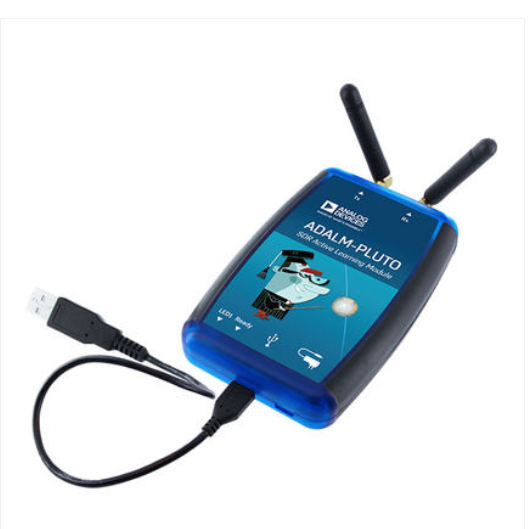
In my previous proposal, I used the PLUTO device to transmit a 2.4 GHz signal with a power of 3-5 dBm. This signal was then amplified to approximately 40 dBm using a second-stage amplifier, which met the uplink requirements for QO-100. Additionally, the QO-100 signal could be received by PLUTO after being downconverted to 739 MHz via an LNB.

The amplifier can be obtained from Taobao or other sources. When purchasing a WLAN amplifier or WiFi booster, the seller's description should indicate a discount on power output. Alternatively, a custom amplifier can be created. Zhao Teacher's research on this topic is very thorough; please refer back to his post for further study.
Please refer toZhao's post

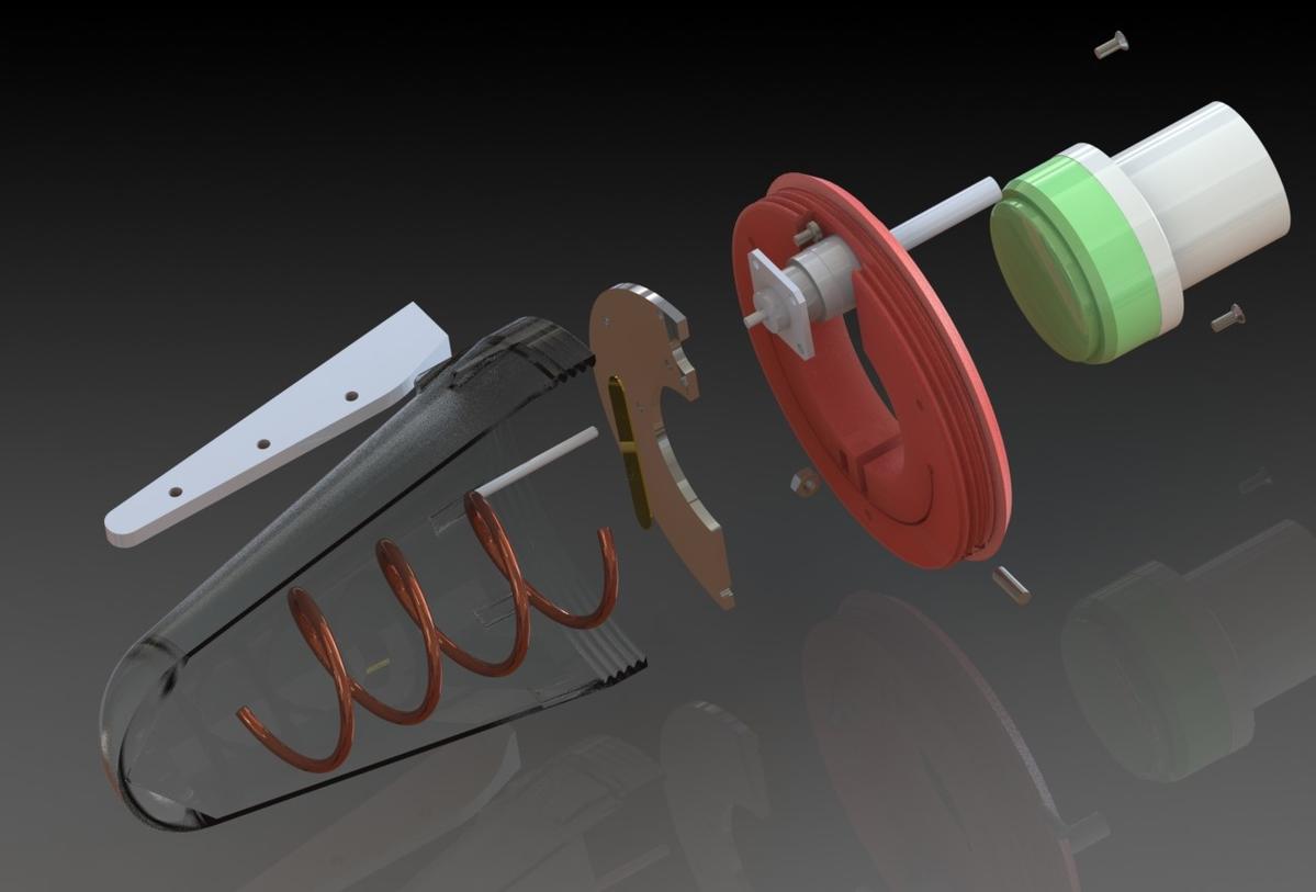
It is important to note that finding a suitable 2.4 GHz feed source can be challenging. If you want to experience a basic version, you could even purchase something like "2.4G grid antenna" on Taobao and use it for transmitting (TX). Ideally, you would need a circularly polarized 2.4 GHz feed source because the satellite transmits RHCP (right-hand circular polarization), so pairing it with a parabolic antenna should use LHCP (left-hand circular polarization). The signal's polarization direction will reverse after reflection (RHCP and LHCP are swapped).

There's a lot of information available online about circular polarization feed sources, and most people are using one of two main approaches.
Parabolic antenna
According to the official QO-100 recommendations, the diameter of the antenna in narrowband mode should be no less than 120cm. However, practical tests within China have shown that antennas with a diameter of 60cm or more can achieve good results over domestic coverage areas. In regions with high elevation angles, such as Xinjiang, even antennas as small as 45cm can perform very well. However, for fixed base stations, the larger the antenna diameter, the better, as this translates to a stronger downlink signal-to-noise ratio and lower uplink power.
However, larger parabolic antennas also mean a larger size and more concentrated signal lobes, which makes it more difficult to locate the beacon. Fixed station setups can typically consider antennas ranging from 90-120cm or even larger. For temporary field setups, I believe that a size of around 60-75cm is a good choice, as this size provides a balance between antenna volume and gain.

There are several different brands of Ku pots available on the market, which can be broadly categorized as:
It is important to note that there are differences between the forward and reverse orientations. The forward orientation has the feed pole below, which is suitable for satellites at high angles of elevation. For the QO-100 satellite, it is recommended to use the reverse orientation, i.e., the feed pole on the upper end of the parabolic reflector. According to Mr. Zhao's description, the forward orientation can cause various problems, and in general, it is not suitable for satellites at low angles of elevation. The reverse orientation can solve these uncertainties more reliably. The following diagram shows the reverse orientation.

The author used the equipment.
I first became aware of Professor Zhao's post in late 2019. After further investigation, I believed that there was a potential coverage area of around 0.3 degrees in the Baise region of Guangxi. However, after conducting on-site surveys, I discovered that the city of Baise is located in a basin and has mountains to the west with slopes of 2-3 degrees, which prevented QO-100 from functioning properly. This led to delays. Nevertheless, I continued working using amateur satellite communications during this period.

In early 2025, I traveled to Lanzhou with my girlfriend for the New Year holiday. Under the guidance of BG9HKP in Lanzhou, we performed our first actual QO-100 operation and gained a firsthand experience of the entire system. Although I had already familiarized myself with the entire system through discussions on forums or WeChat groups, the practical experience was different from what I had imagined. In particular, I learned a lot about the tolerance for deviation in the parabolic antenna's pointing direction, the pointing status of the feed antenna at low angles, the installation method of the antenna and tripod, and the overall linking method of the system. The experience was particularly valuable, especially the 1-degree angle in Lanzhou, which is similar to the -0.3-degree angle in Guangxi, both of which are very low-angle communication links, providing a good reference.


After returning from the Spring Festival in Lanzhou, I started planning the QO-100 expedition to Guangxi. The first step was to address the overall system issues. My initial plan involved using PLUTOSDR as the core component because it covers a frequency range of 60-6000 MHz, allows for direct transmission of 2.4 GHz signals, and supports full duplex operation, enabling reception of the 739 MHz downlink signal during transmission. This is a commonly used setup, as illustrated below.

Therefore, we purchased the external LNAs according to our plan, with the intention of using a GPSDO for stable downconversion. We also borrowed a BH2SRJ PLUTO unit to experiment with, and purchased a 75cm parabolic dish. Everything was going well when Zhao Teacher announced a major development in the QO-100 group.

Everything became much simpler. Once the entire plan was scrapped and I obtained the variable frequency converter using cash, Mr. Zhao also kindly provided a 2.4G source, which allowed me to immediately stop my half-finished project of building one myself. Now, all that's left is to solve the antenna, bracket, and LNB issues, and the power supply and radio are easy to handle.

The actual antenna I used was a 60cm portable parabolic dish, purchased from Yellow Fish. The price included shipping and was 130 yuan. After receiving it, I made some simple modifications to adapt it for use with a hydraulic mount, making it easy to quickly install on the mount. This aspect pleased me greatly, as not only is the installation quick, but I can also easily fine-tune its direction using the hydraulic mount to locate the beacon.


Initially, we planned to purchase the standard LNB with free shipping for 20 yuan. However, after testing, we found that the frequency was unstable and took approximately 20 minutes to stabilize. We would like to thank BI6OPR for providing the KC901S+.I used it to transmit a signal at 3463 MHz, and successfully obtained a 10389 MHz signal source using tripling frequency dispersion. I then performed stability measurements on the LNB. After comparing, I found that the LNB sold by a vendor on Taobao for 120 RMB was expensive, but it met the requirements of QO-100, so I purchased one at a high price.

Because the inverter requires a 24V voltage, while our radio only uses 13.8V, we purchased a high-quality wide-voltage to 24V converter to make it easier to use. Although it was expensive, the results were very good. Testing showed an output voltage of 23.9V, which remained stable even as the lithium iron phosphate battery's voltage gradually decreased.

At this point, the QO-100 expedition equipment has been fully debugged and consists of:
- 60cm diameter offset feed system, with LNB mount, modified for quick assembly on a tripod.
- Hydraulic tripod for camera mount, allowing for quick installation of pan and tilt, as well as fine adjustments to aiming direction.
- QO-100 transceiver, 2.4 GHz uplink transmission, 10 GHz downlink reception
- 2.4 GHz helical feed, left-handed circular polarization, compatible with fixed LNB interface
- Use a stable LNB to prevent CW SSB FT8 from failing due to frequency drift.
- As the driving radio IC-705, I would like to thank Mr. Miao (BD4SDO) for his support.
- A step-up transformer with a 13.8V to 24V output, featuring an XT60 connector.
- Various patch cables
Overview of the Guangxi QO-100 Expedition
End of September: Purchase variable frequency drive (VFD)
In late September, under the guidance of Mr. Zhao from PY, we obtained a variable frequency converter and a 2.4 GHz feeder. This means that by simply resolving the antenna and LNB issues, we could already meet all the requirements for setting up the QO-100 system.

Mid-October: Finding a suitable location for setup.
The equipment is mostly complete; the remaining task is choosing the expedition location. Given that the angle in Yangqiao, Guangxi, is quite low (official website indicates -0.3 degrees), it's clear that the optimal location must be at the top of a mountain. After careful research and analysis of Google Maps' 3D terrain data, the chosen expedition site is located in Tangshan Mountain, De Bao County.

There are several advantages to having a triangular mountain:
- It is conveniently located near De Bao County town, making it easy to return to town for rest and relaxation at any time.
- There is a paved road that leads directly to the summit, and it appears there may be a television broadcasting station located at the top, possibly with someone on duty.
- Trigonal Mountain is the highest peak near De Bao. If communication is not possible here, you can only go to Yunnan province.

However, no one could have imagined how difficult this expedition would be.
End of October: Pack up expedition equipment and finalize expedition date.
After all the equipment had been tested and packed, I sent them to my friend BI1QJQ in Nanning. Since I needed to consider his schedule, sending the equipment ahead of time and waiting for the expedition date to be confirmed was a good option.
In late October, the antenna and tripod will be shipped to Nanning. After two days, the frequency converter testing will also be completed and shipped to Nanning. The 705 unit will be carried by the author to Guangxi. Power supply will be provided by BI1QJQ.
On October 31st, BI1QJQ finally confirmed the departure date, and subsequently purchased a round-trip ticket from November 2nd to November 6th. After discussing the expedition's departure date and considering the actual situation, the initial plan was set for departures between November 3rd and 5th:
- Depart at 3 PM, arrive in the evening, rest briefly before ascending and conducting installation tests in the evening.
- On Monday morning, I took a break in the morning and then left for work after lunch. In the afternoon and evening, I worked.
- On Saturday morning, we rested. We departed in the middle of the day to set up. In the afternoon, we packed up and returned to Nanning.
Planned work for 3 days, estimated 20 hours of operation, operating mode: CW SSB FT8.
Furthermore, having released the advance notice of the expedition, we now have reason to believe that foreign media will pay particular attention to it.

November 3-5: Far East QO-100
3: Meeting and departure, difficult arrival.
On November 3rd, Nanning had light rain. Due to the uncertainty of the interview with QJQ in the morning, the departure time was delayed from 2:00 PM until 4:00 PM. The estimated travel time from Nanning to De Bao County is 3 hours and 30 minutes, but due to short breaks along the way, we arrived at the hotel around 8:00 PM.

After eating a tasteless bowl of instant noodles at a restaurant next to the hotel, we packed our gear and set off on the dark mountain road. When we reached the outskirts of the county town, we were stopped by a sign indicating that the road to Mount Triangle was closed due to construction, making it impassable for large vehicles. The detour would take approximately 1 hour, so considering the late time and the tiring journey, we decided to abandon the plan and return to the hotel to try again the next day at noon.


4. Successfully overcome all obstacles and complete the communication link.
On November 4th, De Bao experienced cloudy and partly sunny weather. Myself and QJQ woke up at 11 am, had a quick shower, and then went to the town center to enjoy some local noodles. We also bought bread, cakes, and other snacks from a nearby convenience store before setting off for Triangle Mountain at 12:30 pm.


According to the "缺德地图" navigation, I took County Road North and detoured to Triangle Mountain. This was made possible by the village-to-village road project, which resulted in paved roads, but they were relatively narrow, requiring extra caution when merging. Fortunately, QJQ drove very steadily. The road up Triangle Mountain is very steep, with 4.2 kilometers of uphill driving and a 530-meter elevation gain. Many sections have slopes exceeding 30 degrees, and there were several instances where the car slipped while climbing. I decided to continue on the main road, and the car didn't stall halfway up.


Arriving at the summit of Triangle Mountain around 2:00 PM, I found that it was indeed a TV tower relay station. However, the main gate was locked, and there was a dog guarding the entrance. Furthermore, the summit was already shrouded in clouds, with heavy fog surrounding it. Therefore, I proceeded to test the equipment on the adjacent hillside.

14:30 The basic setup is complete. The most crucial step in using the QO-100 is to locate a beacon. If you can receive the beacon signal, that's all there is to it. However, locating the beacon was not easy. I took out my phone's compass and, based on previous calculations, the satellite should be at an azimuth of 266 degrees. I then pointed the antenna in the direction indicated by the compass as 266 degrees, and made small adjustments to the elevation angle. However, the QO-100 beacon signal never appeared on the waterfall chart at 705. Could it be that the altitude is not high enough? Or could the bad weather and rain be interfering with the signal? Or is there a problem with the azimuth or elevation angle?
To eliminate interference from distant trees, the author and QJQ moved the entire system to a more open location where they could visually observe the entire western lowlands. Standing on the summit of Triangle Mountain, even with some mist, they could still see the distant, low-lying hills – this was indeed the highest peak in the surrounding area, and theoretically, receiving satellite signals should not be a problem.


So, what exactly caused the failure to receive the signal? I walked slowly from the tower location to the broadcast station's main gate, repeatedly considering possible reasons:
- The signal strength is too low, and the satellite signal is being blocked by mountains; this can be largely ruled out because we can already see very distant mountain ranges in the west, and it's unlikely that the mountains will block the satellite signal.
- Due to fog and drizzle, the signal strength has decreased, making it impossible to decode; however, after analysis, I don't think this is a likely cause. The effect of fog on 10GHz signals is relatively weak, around 3-5dB, which won't cause such a significant QSB (signal fading) as heavy rain.
- The terrestrial feed system is malfunctioning and unable to receive satellite signals. This is unlikely, as after powering on the frequency converter, a noticeable increase in noise at 705 Hz can be observed, indicating that the frequency converter is functioning correctly. Furthermore, the entire system has already been tested in Zhejiang province, confirming that it functions properly.
- The antenna's azimuth and elevation angles were not properly aligned, resulting in an inability to receive satellite signals; this seems to be the only possible explanation.
Therefore, I returned to the original location and ensured that the parabolic antenna was far enough away from the metal structure to avoid interference. Using his phone's compass, he found that the bearing indicated by his phone was approximately 266 degrees, which was slightly off to the right compared to my own phone's compass, with a difference of about 3-4 degrees. Despite this, I adjusted the parabolic antenna to the right in an attempt to improve reception, but still received no signal. A sense of frustration began to creep in – could it be that something was blocking the signal? Was QO-100 simply not usable in Guangxi? Given the cost of the equipment and the travel expenses involved, would it really be worthwhile?
After discussing the issue in a WeChat group, I decided to try adjusting the direction and angle again. After slightly increasing the antenna's elevation angle, a miracle occurred – I saw two intersecting peaks on the IC-705 waterfall chart. I immediately recognized this as the QO-100 beacon signal, and quickly double-clicked the waterfall chart to adjust the frequency while simultaneously increasing the volume. By adjusting the direction based on the changes in the beacon strength, I finally obtained a clear and stable beacon signal.

Receiving the beacon indicates that QO-100 is fully operational at this location, and we can immediately set up the radio for connection. At the same time, we enable RIT operation based on the beacon's frequency to ensure that both the uplink and downlink are in the correct states. After making the adjustments, we search for signals on the specified frequency and find the FT8 frequency for QO-100 at 10389.540MHz. After debugging, we use "BG7XWF OL33" to perform a test transmission using FT8. In the following cycle, European robots flooded in, completely surrounding us. At this point, we successfully used this geostationary satellite with an inclination of -0.3 degrees in Guangxi.


After approximately 45 minutes of QSO on FT8, and after determining that the system was functioning normally, we adjusted the frequency to 10489.710 MHz, which is the SSB communication band. When we used the OL33 grid to make a CQ call, even at UTC 06:00, replies from Europe flooded in like a tsunami, completely overwhelming BI1QJQ and creating a situation that had never been experienced before – an enormous number of SSB signals all mixed together, making it difficult to decipher individual letters intermittently. Occasionally, foreign stations would use QRO (high power) to overwhelm the signal, allowing them to clearly hear the callsign. However, immediately after this, the satellite's over-power alarm sounded. In this way, we struggled to make SSB QSOs amidst the constant beeping alarms. This situation also clearly revealed our shortcomings when dealing with pile-ups – experienced expedition stations would use techniques like "UP" (calling out sequentially) or zone calling to ensure orderly queuing and improve efficiency. However, we lacked sufficient experience in handling pile-ups, especially when there were over 10 replies at once. We could only work under extreme interference, which was frustrating for both us and the foreign stations. This situation requires reflection and adjustment. In the context of expedition stations, "UP" is essential, as it can ensure that our own signals are not overwhelmed by other stations trying to make contact.


After approximately 6 hours of QSO, the battery voltage had dropped significantly, and it was getting dark. The temperature at the summit had also started to drop rapidly. We decided to pack up our equipment and descend at 21:00. Unlike the anxious and apprehensive feeling we had when we arrived, this descent was much more relaxed and enjoyable. However, we remained very cautious as we slowly descended at a speed of 15 km/h for about 20 minutes before finally reaching the foot of the mountain. We then returned to the hotel at 22:30.
After returning to the hotel and freshening up, I was able to open my computer, check the posts, and copy some image files. QJQ also ordered a very elaborate barbecue dinner as a celebration.🎉。

In the picture, the beer was consumed by me personally; QJQ did not drink any alcohol throughout the event.
Day 5: Climb Mount Xiangshan again, return to Nanning.
November 5th, clear and sunny. However, the clouds were still quite thick, which was good because it didn't rain. The roads were very dry, making hiking safer than in the previous few days with overcast weather. It was definitely a better day. I got up around noon to pack my equipment and check its charging status. QJQ was so excited that he didn't fall asleep until late at night; he was still catching up on sleep.
After a simple wash and lunch, the two members of the expedition set off at 12:00. They arrived back at the summit around 13:00, and this time the setup process went very smoothly. I was responsible for setting up the equipment, while QJQ was in charge of setting up the tables and chairs and bringing batteries. Once everything was set up, we turned on the radio, and the QO-100 beacon appeared directly on the spectrum.


For the plan on the 5th, I've tentatively decided to focus on CW with a frequency of 515 kHz. Previously, I had promised to do CW QSOs with them, but I haven't been able to implement it yet. QJQ will primarily use FT8 for passive operation. SSB was avoided due to the high level of interference, so I only attempted it briefly after contacting two stations before immediately switching to another frequency. Because CW involves transmitting from a radio station, and I set my transmission content to "CQ BG7XWF BG7XWF OL33 UP," foreign stations responded very well. The signals they sent were mostly within the 515.5-517 kHz range, with occasional signals on the same frequency. After hearing my "UP" transmission, they cooperated and transmitted from a higher location. Everything went smoothly. However, since it was early morning in Europe, I only managed to complete over 30 QSOs before having to reluctantly stop listening.

The check-in time for station 5 lasted from approximately 13:30 to 16:00, totaling 2 hours and 30 minutes. There were approximately 80+ stations using the QO-100 frequency, which is a significant decrease compared to yesterday. This was mainly due to time constraints. To maximize QSO opportunities, users of QO-100 (primarily European users) preferred to operate in the evening. After completing the tasks, the remote team began packing up and departing from 16:30, marking the end of this expedition using the QO-100 frequency in Guangxi.
Epilogue: A trip to Baise; enjoying tea at Dehan.
After leaving De Bao, we didn't directly return to Nanning. Instead, after learning that I was in Baise, Mr. BA7QT invited us for a simple meal in Baise. We rushed all the way there and arrived at a hot pot restaurant in the city center of Baise at 18:30. The place was incredibly crowded, with fresh ingredients. According to Mr. BA7QT, if you didn't arrive by 17:00, you wouldn't be able to get a seat by 18:00. I looked out at the queue of people waiting outside, and he was right.


After enjoying a hot pot dinner and drinks, we visited the B7Q base for an educational tour, drank tea and relaxed. We then departed Nanning at 21:00 and arrived in Nanning at 00:30 on the 6th, marking the end of our QO-100 expedition.
Post-event summary
This QO-100 expedition to Guangxi was the first time a QO-100 was operated in that region, taking three days and resulting in 282 QSOs. It provided valuable experience for operating in low-angle areas. After careful analysis and review, the following conclusions were reached.
The positive aspects
- The power supply side was well-prepared, with no unexpected issues. The assembly process followed the correct procedure, and the entire system could be assembled within 15 minutes.
- Pre-plan the location, selecting a site that meets expectations. Triangle Mountain should be the primary location, with several alternative locations available as backups.
- The expedition activities are progressing smoothly with no unexpected incidents. All modes of operation have been successfully implemented.
Areas for improvement
- When facing SSB stacking with insufficient experience and low efficiency, improvements can be made through methods such as UP.
- The timing of the expedition was awkward, with work plus late-night European hours resulting in a small number of participants. It would be much better if it were held on a weekend and overnight.
- There is room for optimization in terms of power supply. The system can be powered by a portable charger and a "lure" cable to provide power to both the computer and the radio, while a separate inverter provides power to the converter, ensuring extended battery life.
To conclude
I would like to thank those who provided assistance with QO-100, which made this expedition possible. Finally, a reminder: even though the 2.4 GHz frequency is in the amateur band, it still needs to be tested before use to avoid interfering with other services such as Wi-Fi and data transmission (bushi). This article is solely for technical discussion; if you disagree, that's your decision.



 闽ICP备2021006864号-7
 闽公网安备35020602002794号